
Tree Inventories and Canopy Assessments: What Every Municipality Should Know
Did you know that the urban forests of the United States alone provide over $18 billion in annual ecosystem service benefits, ranging from air pollution removal to stormwater reduction? You can’t just know the trees – you need the right data. Many cities mix up the two main tools: the Tree Inventory and the Tree Canopy Assessment (TCA).
The TCA gives you the big-picture view. It helps you set city-wide goals and plan for green space equity. On the other hand, the Tree Inventory shows you details for each tree. You can use it to plan maintenance, check safety, and manage your budget.
You need to see how these tools serve different purposes – and how they work together. Once you do, you can manage your urban forest effectively and make smarter, data-driven decisions.
What Is a Tree Inventory?
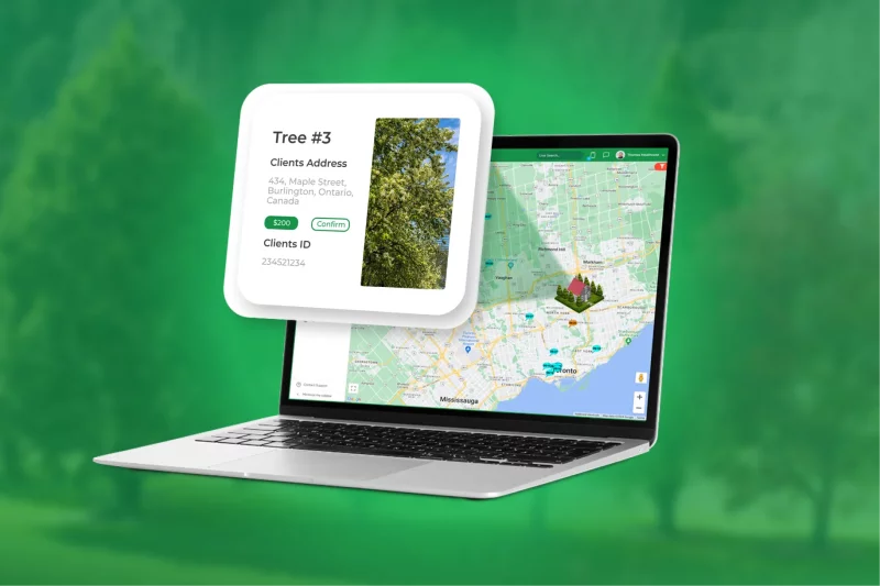
It is a point where everything starts when talking about managing urban forestry. It means that you keep a detailed record of every tree in a particular area (for example, a park) or an entire city. It’s like a full count of your trees.
So, when you create a Tree Inventory, you collect key information about each tree:
-
Species and botanical name;
-
Size, usually measured as diameter at breast height;
-
Exact location, often with GPS coordinates;
-
Health and condition;
-
Risks or maintenance needs (pests, diseases, structural problems, etc.).
For cities, this detailed information is crucial. You need it for efficient urban canopy management. Moreover, it helps you make smart decisions about where to plant trees, when to prune them, how to handle hazards, and how to plan your budget. In the end, a good tree inventory lets cities get the most environmental, visual, and economic value from their urban forests.
What Is a Tree Canopy Assessment?
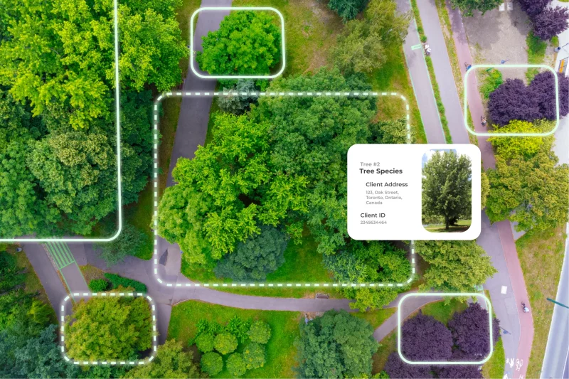
You can’t see the forest for the trees – but with a Tree Canopy Assessment (TCA), you actually can. A TCA measures how much of your city’s land is covered by trees – the leaves, branches, and stems that form the urban canopy.
You gather this data using:
-
High-resolution satellite imagery;
-
Aerial photography;
-
LiDAR scanning.
Next, you process it in Geographic Information Systems (GIS) software to map canopy coverage across neighborhoods and parks.
The insights help you:
-
Set city-wide tree cover goals;
-
Spot areas with low canopy for new planting;
-
Protect existing trees strategically;
-
Reduce urban heat and improve air quality.
TCA gives you the big-picture view, so you can make smart, targeted decisions for planting, preservation, and city tree planning.
Tree Inventories vs. Canopy Assessments: Key Differences
Consider a Tree Inventory and a Tree Canopy Assessment (TCA) as two perspectives of a city seen from different heights.
Tree Inventory (Tactical, Asset-Level View)
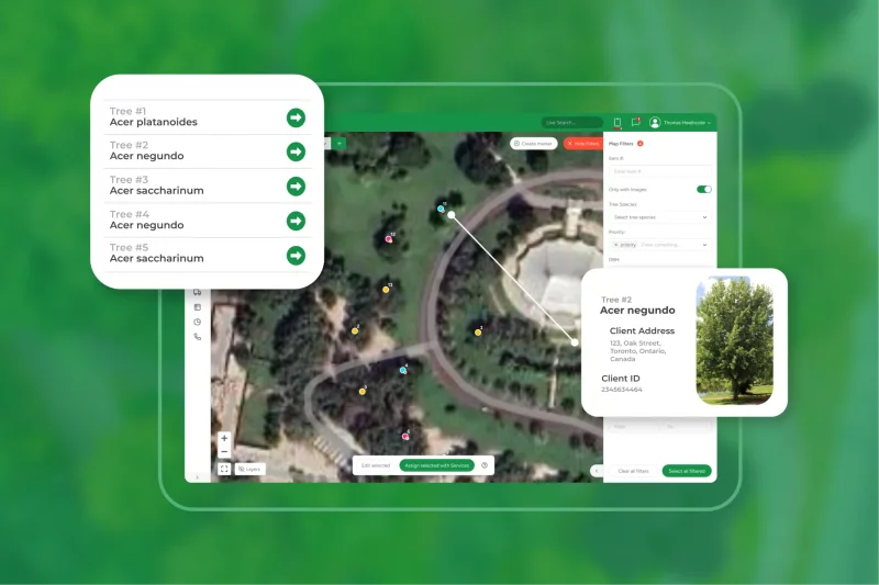
This is a hands-on, detailed check of trees. Field crews go out and use GPS or GIS tools to log each tree’s species, size, health, and structural risks. They also note pests, diseases, and damage from storms.
Well, Granny would say it like this: You start by using this information to plan things like pruning, removals, and fertilizing. Then, it helps you spot problems early, keep people safe, and make trees live longer. But remember, this work takes a lot of time and effort, it costs more, and you need to keep checking and updating it to make sure your information stays correct.
Canopy Assessment (Strategic, Macro View)
This is a top-down, big-picture approach. You use satellites, aerial photos, or LiDAR data and process them in GIS tree mapping software. Alright, Granny would put it like this: This method lets you see how much of the city is shaded by trees, including both private yards and public parks. Then, you can figure out long-term goals for growing more canopy, spot neighborhoods that need more trees, and plan plantings where they’ll help the most.
And the best part is, you get a clear view of the whole city without having to check every single tree. So, while the Tree Inventory tells you exactly what’s on the ground, the Canopy Assessment shows you the big picture and helps plan for the future.
Why Municipalities Need Both
Municipalities need both a Tree Inventory and a Tree Canopy Assessment because each provides insights the other cannot. The Canopy Assessment measures total tree cover, sets long-term goals like reaching 30% canopy, and identifies priority planting areas, such as heat-vulnerable neighborhoods or underserved communities.
The Tree Inventory works at the ground level. You collect data on each tree – species, size, health, and hazards – so you know exactly what to prune, maintain, or remove.
When you combine the two, you get a complete urban forest strategy. The canopy data gives a strategic vision, showing where to focus planting or conservation. The inventory data gives tactical guidance, telling you how to act on that strategy.
Modern platforms like Arbostar make this even easier. They let you link GIS layers from the canopy assessment with precise inventory data, track progress over time, and manage daily maintenance in one system.
Here’s a simple comparison:
| Feature | Tree Canopy Assessment | Tree Inventory |
|---|---|---|
| Focus | City-wide coverage | Individual trees |
| Purpose | Strategic city tree planning | Daily management |
| Data | % of land covered by trees, priority planting zones | Species, size, health, risk, location |
| Scope | Public and private land | Mostly public property |
| Cost | Lower per update | Higher per update |
| Update Frequency | Less frequent | More frequent |
| Use Case | Set long-term goals, track canopy trends | Prune, remove, maintain, monitor hazards |
| Integration | Provides the “where” | Provides the “what and how” |
| Support Tools | GIS, remote sensing | Arbostar or similar platforms for linking to TCA data |
Final Thoughts
A city can’t manage its urban forestry well using only one tool. The Tree Canopy Assessment shows the “why” – the long-term goals, priorities, and areas that need the most attention. The Tree Inventory shows the “how” – exact details on species, health, and maintenance for each public tree. By linking the city-wide canopy view with the detailed tree inventory, city leaders can move past reactive tree care. They can keep the urban forest safer, healthier, and more valuable for the community.
A municipality cannot achieve best practices in urban forestry by relying on just one of these tools. A Tree Canopy Assessment gives the “why” – the strategic justification, the long-term goal, and the equity-based priorities for where to invest. The Tree Inventory provides the “how” – the precise information on species, condition, and maintenance required for every public tree to ensure the urban forest is safe, healthy, and growing.
FAQ: Tree Inventories and Canopy Assessments
What’s the main difference between an inventory and a canopy assessment?
A Tree Inventory is a bottom-up, tactical assessment of individual trees (health, species, maintenance needs), whereas a Canopy Assessment is a top-down, strategic measure of total tree crown coverage (percentage of land area).
Can canopy assessments replace detailed inventories?
No. Canopy assessments provide a necessary strategic overview and a baseline for goals, but they cannot provide the individual tree health and risk data required for tactical daily management and maintenance prioritization.
How often should municipalities update their data?
Tree Inventories should be reviewed and updated continuously or annually for critical public trees, and fully re-inventoried every 5 to 10 years. Canopy Assessments are typically updated every 5 to 10 years to monitor long-term trends.
What software supports both inventories and canopy data?
Integrated software platforms like i-Tree (e.g., i-Tree Eco and i-Tree Canopy) and commercial solutions like TreePlotter (PlanIT Geo) are designed to manage and link both detailed inventory and high-level canopy data.